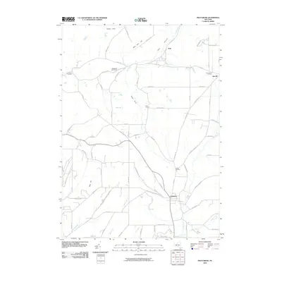
2010 Map of Prattsburg
USGS Topo · Published 2010About this map
Prattsburg serves as the primary hub in this southern Finger Lakes region, where the landscape is defined by the steep-sided Italy Valley and the branching waters of Flint Creek. The geography reveals a classic upland agricultural pattern, with family-named locations such as the Mackenzie Family Farm and remote settlements like Italy Hill connected by a network of winding roads like Italy Tpke and Italy Valley Rd.
Find a feature on this map
79 named features on this map. Tap any name to fly to it.
Don’t see what you’re looking for? This feature index may not catch every label — zoom into the map to look around manually.
Map Details
Editions of this 2010 Prattsburg Map
This is the sole edition of this map. No revisions or reprints were ever made.
Other maps of this area

1900 · Naples
USGS Topo · 1:62,500

1903 · Naples
USGS Topo · 1:62,500

1903 · Penn Yan
USGS Topo · 1:62,500

1903 · Hammondsport
USGS Topo · 1:62,500

1910 · Bath
USGS Topo · 1:62,500

1913 · Naples
USGS Topo · 1:62,500

1942 · Naples
USGS Topo · 1:31,680

1942 · Prattsburg
USGS Topo · 1:31,680
1942 · Bristol Springs
USGS Topo · 1:31,680

1942 · Pulteney
USGS Topo · 1:31,680