
1942 Map of Pulteney
USGS Topo · Published 1942About this map
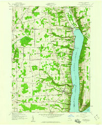
The western branch of Keuka Lake and the steep slopes of Bluff Point Ridge dominate this landscape, illustrating the agricultural and seasonal patterns of the central Finger Lakes during the early 1940s. The settlement of Pulteney serves as a local hub near the shoreline, supported by smaller hamlets like Branchport to the north and South Pulteney to the south. The mapping reveals a well-established network of rural education and memorial sites, including School No. 7 and the Garrett Memorial Chapel overlooking the water. In the uplands, family-named landmarks such as Chidsey Point and Gloade Corners punctuate the grid of farm roads. The presence of numerous orchards and vineyards along the lakefront, alongside features like Jubertown Swamp and Guyanoga Creek, highlights the specialized land use dictated by the region's unique microclimate and glacial topography.
Find a feature on this map
56 named features on this map. Tap any name to fly to it.
Don’t see what you’re looking for? This feature index may not catch every label — zoom into the map to look around manually.
Map Details
Editions of this 1942 Pulteney Map
Other maps of this area

1900 · Naples
USGS Topo · 1:62,500

1903 · Naples
USGS Topo · 1:62,500

1903 · Penn Yan
USGS Topo · 1:62,500

1903 · Hammondsport
USGS Topo · 1:62,500

1910 · Bath
USGS Topo · 1:62,500

1913 · Naples
USGS Topo · 1:62,500

1942 · Prattsburg
USGS Topo · 1:31,680

1942 · Penn Yan
USGS Topo · 1:31,680

1942 · Middlesex
USGS Topo · 1:31,680

1942 · Potter
USGS Topo · 1:31,680