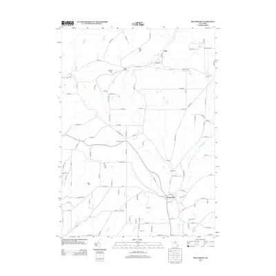
2013 Map of Prattsburg
USGS Topo · Published 2013About this map
Prattsburg serves as the primary hub in this southern Finger Lakes landscape, where deep-cut valleys and upland ridges dictate the local road network. The village is well-defined, showing its central Po and the Rural Cem to the east. The terrain is notably marked by the steep Segar Gully and high points like West Italy Hill, which separate the various drainage basins of the region.
Find a feature on this map
113 named features on this map. Tap any name to fly to it.
Don’t see what you’re looking for? This feature index may not catch every label — zoom into the map to look around manually.
Map Details
Editions of this 2013 Prattsburg Map
This is the sole edition of this map. No revisions or reprints were ever made.
Other maps of this area

1900 · Naples
USGS Topo · 1:62,500

1903 · Naples
USGS Topo · 1:62,500

1903 · Penn Yan
USGS Topo · 1:62,500

1903 · Hammondsport
USGS Topo · 1:62,500

1910 · Bath
USGS Topo · 1:62,500

1913 · Naples
USGS Topo · 1:62,500

1942 · Naples
USGS Topo · 1:31,680

1942 · Prattsburg
USGS Topo · 1:31,680
1942 · Bristol Springs
USGS Topo · 1:31,680

1942 · Pulteney
USGS Topo · 1:31,680