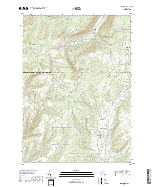
2023 Map of Prattsburg
USGS Topo · Published 2023About this map
Prattsburg sits at the southern edge of this modern landscape where the Finger Lakes region's dramatic topography defines the local character. The settlement pattern follows the deep incisions of Italy Valley, where Flint Creek and its tributaries have carved significant depressions like Conklin Gully and Segar Gully. For family historians, several burial sites are documented across the highlands, including the Italy Hill Cem and the Italy - Naples Cem near the western border. The map captures the meeting point of Ontario, Yates, and Steuben counties, illustrating how modern road networks like Italy Hill Rd and Co Rd 18 navigate the steep rises of West Italy Hill and West Hill. The drainage of Fivemile Creek and Tenmile Creek further marks the area's transition into the southern tier's creek-fed valleys.
Find a feature on this map
108 named features on this map. Tap any name to fly to it.
Don’t see what you’re looking for? This feature index may not catch every label — zoom into the map to look around manually.
Map Details
Editions of this 2023 Prattsburg Map
This is the sole edition of this map. No revisions or reprints were ever made.
Other maps of this area

1900 · Naples
USGS Topo · 1:62,500

1903 · Naples
USGS Topo · 1:62,500

1903 · Penn Yan
USGS Topo · 1:62,500

1903 · Hammondsport
USGS Topo · 1:62,500

1910 · Bath
USGS Topo · 1:62,500

1913 · Naples
USGS Topo · 1:62,500

1942 · Naples
USGS Topo · 1:31,680

1942 · Prattsburg
USGS Topo · 1:31,680
1942 · Bristol Springs
USGS Topo · 1:31,680

1942 · Pulteney
USGS Topo · 1:31,680