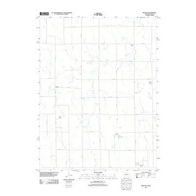
2011 Map of Precept
USGS Topo · Published 2011About this map
Precept serves as the central point in this rural landscape along the Nebraska-Kansas border, where the land is defined by a dendritic network of prairie waterways. The drainage patterns of Sappa Creek, Honey Creek, and Maple Creek carve through the agricultural grid, influencing the placement of early homesteads and community hubs. For genealogists, the map preserves the locations of several burial grounds, including Maple Creek Cemetery, Pleasant Hill Cemetery, and Deaver Cemetery, which are vital markers of the area's early settlement history. Water management is a visible priority in the southern half of the quadrangle, evidenced by the infrastructure at Ehrke Reservoir and Atkinson Reservoir, controlled by Ehrke Dam and Atkinson Dam respectively. This 2011 survey documents a highly organized section-line road system that continues to facilitate the movement of agricultural goods across the Furnas County countryside.
Find a feature on this map
28 named features on this map. Tap any name to fly to it.
Don’t see what you’re looking for? This feature index may not catch every label — zoom into the map to look around manually.
Map Details
Editions of this 2011 Precept Map
This is the sole edition of this map. No revisions or reprints were ever made.
Other maps of this area

1893 · Norton
USGS Topo · 1:125,000

1896 · Arapahoe
USGS Topo · 1:125,000

1898 · Arapahoe
USGS Topo · 1:125,000

1951 · Norton
USGS Topo · 1:62,500

1955 · Grand Island
USGS Topo · 1:250,000

1955 · Beloit
USGS Topo · 1:250,000

1957 · Grand Island
USGS Topo · 1:250,000

1957 · Precept
USGS Topo · 1:24,000

1957 · Beaver City SE
USGS Topo · 1:24,000

1957 · Stamford SE
USGS Topo · 1:24,000