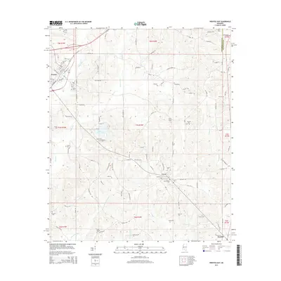
2015 Map of Prentiss East
USGS Topo · Published 2015About this map
Prentiss serves as the focal point of this Jefferson Davis County landscape, where urban streets like Pearl Ave and St Stephens Rd give way to a dense network of rural cemeteries and creek drainages. The area is characterized by a significant number of family and community burial grounds, including Dublin Cem, Holloway Cem, and Saint Elizabeth Cem, which suggest long-standing settlement patterns in the Mississippi Pine Belt. The central portion of the map is dominated by Jefferson Davis Lake, while the hydrology is further defined by the upper reaches of White Sand Cr, Jaybird Creek, and the various forks of Holiday Cr. These watercourses flow through a terrain marked by numerous local routes such as Granby Rd and Polk Oatis Rd. Toward the south, the map captures the transition to the smaller communities of Carson and the northern outskirts of Bassfield, linked by historic corridors that parallel the local creek systems.
Find a feature on this map
109 named features on this map. Tap any name to fly to it.
Don’t see what you’re looking for? This feature index may not catch every label — zoom into the map to look around manually.
Map Details
Editions of this 2015 Prentiss East Map
This is the sole edition of this map. No revisions or reprints were ever made.
Other maps of this area

1953 · Hattiesburg
USGS Topo · 1:250,000

1958 · Hattiesburg
USGS Topo · 1:250,000

1970 · Prentiss West
USGS Topo · 1:24,000

1970 · Bunker Hill
USGS Topo · 1:24,000

1970 · Oak Vale
USGS Topo · 1:24,000

1970 · New Hebron
USGS Topo · 1:24,000

1970 · Prentiss East
USGS Topo · 1:24,000

1970 · Mount Carmel
USGS Topo · 1:24,000

1974 · Lone Star
USGS Topo · 1:24,000

1974 · Bassfield
USGS Topo · 1:24,000