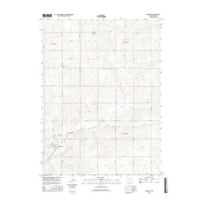
2015 Map of Prescott
USGS Topo · Published 2015About this map
Prescott serves as the central settlement of this southwest Iowa region, situated near the confluence of the E Nodaway River and Mount Zion Br. The landscape is defined by the drainage patterns of the Nodaway watershed, featuring numerous small tributaries such as Shanghai Cr, Kosar Br, and Cipra Br. These waterways cut through the agricultural terrain, influencing the layout of the section-line road network. A high density of rural burial sites provides significant value for local genealogy, including Old Evergreen Cem, Evergreen Cem, and the Bohemian National Cem. The map further documents the rural infrastructure through named thoroughfares like Co Rd H24 and Co Rd H33, alongside the eastern edge of the W Platte River basin. The arrangement of these cemeteries and watercourses reflects a long-established rural community structured around the river forks and homestead boundaries.
Find a feature on this map
45 named features on this map. Tap any name to fly to it.
Don’t see what you’re looking for? This feature index may not catch every label — zoom into the map to look around manually.
Map Details
Editions of this 2015 Prescott Map
This is the sole edition of this map. No revisions or reprints were ever made.
Other maps of this area

1954 · Omaha
USGS Topo · 1:250,000

1955 · Nebraska City
USGS Topo · 1:250,000

1957 · Nebraska City
USGS Topo · 1:250,000

1957 · Omaha
USGS Topo · 1:250,000

1958 · Omaha
USGS Topo · 1:250,000

1958 · Nebraska City
USGS Topo · 1:250,000

1980 · Corning South
USGS Topo · 1:24,000

1980 · Lenox
USGS Topo · 1:24,000

1980 · Nevinville
USGS Topo · 1:24,000

1980 · Corning North
USGS Topo · 1:24,000