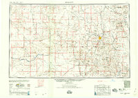
1959 Map of Prescott
USGS Topo · Published 1959About this map
Prescott and the surrounding copper-rich highlands of Yavapai County appear here during a period of significant post-war industrial activity. The landscape is defined by its mining heritage, anchored by the massive Bagdad operations and the Iron King Mine near Humboldt. These industrial hubs are linked by the Atchison Topeka and Santa Fe Railway, which snakes through the high desert terrain to serve remote settlements like Hillside and Kirkland.
Find a feature on this map
82 named features on this map. Tap any name to fly to it.
Don’t see what you’re looking for? This feature index may not catch every label — zoom into the map to look around manually.
Map Details
Editions of this 1959 Prescott Map
2 editions found

Other maps of this area

1886 · Diamond Creek
USGS Topo · 1:250,000

1886 · Camp Mohave
USGS Topo · 1:250,000

1886 · San Francisco Mtns
USGS Topo · 1:250,000

1886 · Chino
USGS Topo · 1:250,000

1887 · Verde
USGS Topo · 1:250,000

1887 · Prescott
USGS Topo · 1:250,000

1891 · San Francisco Mtns
USGS Topo · 1:250,000

1891 · Chino
USGS Topo · 1:250,000

1892 · Verde
USGS Topo · 1:250,000

1892 · Diamond Creek
USGS Topo · 1:250,000