
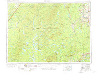
1954 Map of Presque Isle
USGS Topo · Published 1968About this map
Aroostook River drainage defines this vast North Woods landscape, where logging and transit hubs like Presque Isle and Ashland anchor a network of remote settlements and timber-rich terrain. The map captures the region during a period of transition, showing the extensive Bangor and Aroostook and Canadian Pacific rail lines that once fueled the area's timber and potato industries. To the south, the massive preserve of Baxter State Park includes prominent peaks like Traveler Mountain and Wasataquoik Mountain, indicating the shift toward conservation and recreation in the mid-20th century.
Find a feature on this map
189 named features on this map. Tap any name to fly to it.
Don’t see what you’re looking for? This feature index may not catch every label — zoom into the map to look around manually.
Map Details
Editions of this 1954 Presque Isle Map
2 editions found
Other maps of this area

1921 · Van Buren
USGS Topo · 1:250,000

1927 · Stockholm
USGS Topo · 1:48,000

1927 · Katahdin
USGS Topo · 1:48,000

1927 · Square Lake
USGS Topo · 1:48,000

1928 · Eagle Lake
USGS Topo · 1:48,000

1928 · Winterville
USGS Topo · 1:48,000

1929 · Portage
USGS Topo · 1:62,500

1929 · Caribou
USGS Topo · 1:48,000

1930 · Katahdin
USGS Topo · 1:62,500

1930 · Greenlaw
USGS Topo · 1:48,000