1915 Map of Preston
USGS Topo · Published 1954About this map
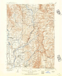
Preston and the surrounding agricultural valleys of southeastern Idaho are captured here during a period of significant irrigation development and railway expansion. The landscape is defined by the Bear River and an intricate network of water management, including the West Cache Canal, Oneida Canal, and the Mound Valley Reservoir. These systems support a string of early settlements such as Dayton, Whitney, and Riverdale. In the higher elevations of the Bear Lake Range, a series of forestry outposts like the Franklin Basin Ranger Station and Meadow View Ranger Station mark the early management of the region's timber and watershed resources.
Find a feature on this map
105 named features on this map. Tap any name to fly to it.
Don’t see what you’re looking for? This feature index may not catch every label — zoom into the map to look around manually.
Map Details
Editions of this 1915 Preston Map
2 editions found
Other maps of this area

1909 · Montpelier
USGS Topo · 1:125,000

1911 · Montpelier
USGS Topo · 1:125,000

1911 · Slug Creek
USGS Topo · 1:62,500

1912 · Randolph
USGS Topo · 1:125,000

1914 · Logan
USGS Topo · 1:125,000

1915 · Preston
USGS Topo · 1:96,000

1916 · Logan
USGS Topo · 1:125,000

1918 · Preston
USGS Topo · 1:125,000
1948 · Bancroft
USGS Topo · 1:62,500
1948 · Soda Springs
USGS Topo · 1:62,500