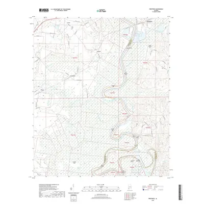
2018 Map of Prestwick
USGS Topo · Published 2018About this map
The Tombigbee River snakes through the heart of this landscape along the border of Washington and Clarke Counties, defining a region of intricate wetlands and sandbars. The river's winding course is marked by numerous features of the bottomland economy, including Sunflower Bend, Harwells Bar, and George Gaines Bar. These alluvial formations, alongside the sprawling Big Swamp, illustrate the shifting nature of the river's path over time, evidenced by the presence of the Upper Cutoff and Lower Cutoff.
Find a feature on this map
84 named features on this map. Tap any name to fly to it.
Don’t see what you’re looking for? This feature index may not catch every label — zoom into the map to look around manually.
Map Details
Editions of this 2018 Prestwick Map
This is the sole edition of this map. No revisions or reprints were ever made.
Other maps of this area

1943 · Choctaw Bluff
USGS Topo · 1:62,500

1943 · McIntosh
USGS Topo · 1:62,500

1944 · McIntosh
USGS Topo · 1:62,500

1946 · Choctaw Bluff
USGS Topo · 1:62,500

1953 · Andalusia
USGS Topo · 1:250,000

1953 · Hattiesburg
USGS Topo · 1:250,000

1957 · Andalusia
USGS Topo · 1:250,000

1958 · Hattiesburg
USGS Topo · 1:250,000

1972 · St. Stephens
USGS Topo · 1:24,000

1978 · Jackson
USGS Topo · 1:24,000