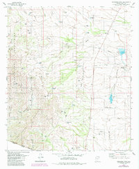
1979 Map of Presumido Peak
USGS Topo · Published 1984About this map
The Papago Indian Reservation occupies the rugged western half of this 1970s landscape, where the Baboquivari Mountains and Pozo Verde Mountains form a dramatic barrier along the international border. In this arid frontier environment, the spatial pattern of life is defined by water management and ranching operations. Numerous livestock tanks, such as Tony Tank and Big Bertha Tank, are scattered throughout the desert flats to support remote outposts like Los Encinos Ranch and Sierra Vista Ranch.
Find a feature on this map
50 named features on this map. Tap any name to fly to it.
Don’t see what you’re looking for? This feature index may not catch every label — zoom into the map to look around manually.
Map Details
Editions of this 1979 Presumido Peak Map
2 editions found
Other maps of this area

1920 · Arivaca
USGS Topo · 1:125,000

1921 · Old Glory
USGS Topo · 1:125,000

1941 · Presumido Peak
USGS Topo · 1:62,500

1941 · Arivaca
USGS Topo · 1:62,500

1942 · Oro Blanco
USGS Topo · 1:62,500

1943 · Fresnal
USGS Topo · 1:125,000

1943 · Arivaca
USGS Topo · 1:62,500

1943 · Old Glory
USGS Topo · 1:125,000

1943 · Presumido Peak
USGS Topo · 1:62,500

1944 · Oro Blanco
USGS Topo · 1:62,500