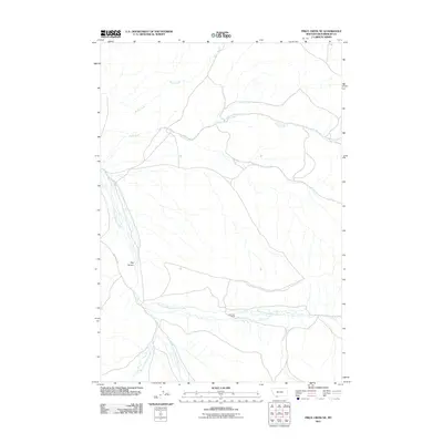
2011 Map of Price Creek NE
USGS Topo · Published 2011About this map
Andersen Ranch sits as a lonely marker of settlement within this drainage-heavy landscape of southwest Montana. The geography is defined by the complex branching of Blacktail Deer Creek, including its East Fork, Middle Fork, and West Fork. These waterways cut through the terrain alongside other seasonal and perennial flows like Rock Creek and Brock Creek. The high-relief features are anchored by Red Canyon, while Blacktail Rd provides the primary transit artery through the valley. This 2011 survey by the U.S. Geological Survey captures the modern ranching footprint and hydrological patterns of Beaverhead County, providing a precise record of water rights and land use in a region where the creek forks determine the layout of the land.
Find a feature on this map
10 named features on this map. Tap any name to fly to it.
Don’t see what you’re looking for? This feature index may not catch every label — zoom into the map to look around manually.
Map Details
Editions of this 2011 Price Creek NE Map
This is the sole edition of this map. No revisions or reprints were ever made.
Other maps of this area

1893 · Dillon
USGS Topo · 1:250,000

1955 · Dubois
USGS Topo · 1:250,000

1955 · Dillon
USGS Topo · 1:250,000

1957 · Dillon
USGS Topo · 1:250,000

1958 · Dubois
USGS Topo · 1:250,000

1958 · Dillon
USGS Topo · 1:250,000

1961 · Red Canyon
USGS Topo · 1:24,000

1961 · Elk Gulch
USGS Topo · 1:24,000

1962 · Dillon
USGS Topo · 1:250,000
1963 · Belmont Park Ranch
USGS Topo · 1:24,000