
1961 Map of Red Canyon
USGS Topo · Published 1964About this map
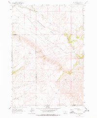
Sweetwater Basin dominates the northern reaches of this high-altitude landscape, where the administrative boundary between Madison and Beaverhead counties cuts across the mountains. The map reveals a sparse but functional ranching geography centered on the Ball Ranch near the upper course of Sweetwater Creek. This early 1960s survey documents a network of primitive access routes, including Sweetwater Road and various unnamed jeep trails, which connect isolated water sources vital for livestock, such as Virginia Springs, Crazy Springs Creek, and Wagner Creek. The topography is defined by the sharp descent of Red Canyon and Wood Canyon from the higher elevations of Timber Hill, illustrating the transition from open grazing basins to the dramatic ridgelines typical of this section of the Montana high country.
Find a feature on this map
14 named features on this map. Tap any name to fly to it.
Don’t see what you’re looking for? This feature index may not catch every label — zoom into the map to look around manually.
Map Details
Editions of this 1961 Red Canyon Map
2 editions found
Other maps of this area

1893 · Dillon
USGS Topo · 1:250,000

1955 · Dubois
USGS Topo · 1:250,000

1955 · Dillon
USGS Topo · 1:250,000

1957 · Dillon
USGS Topo · 1:250,000

1958 · Dubois
USGS Topo · 1:250,000

1958 · Dillon
USGS Topo · 1:250,000

1961 · Mine Gulch
USGS Topo · 1:24,000

1961 · Christensen Ranch
USGS Topo · 1:24,000

1961 · Elk Gulch
USGS Topo · 1:24,000

1962 · Dillon
USGS Topo · 1:250,000