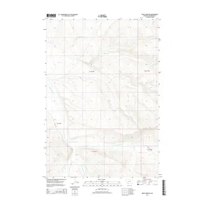
2014 Map of Price Creek NE
USGS Topo · Published 2014About this map
Red Canyon defines the central landscape of this Montana mountain range, where complex drainage patterns converge in the high country of Beaverhead County. The map documents the headwaters of the Blacktail Deer Cr system, showing the distinct paths of the E Fork Blacktail Deer Cr, W Fork Blacktail Deer Cr, and Middle Fork Blacktail Deer Cr as they carve through the terrain. These waterways are mirrored by primitive routes like Blacktail Rd and E Fork Blacktail Rd, which provide the primary access to these remote elevations. In the northern reaches, Rock Cr and Brock Cr drain toward different basins, illustrating the topographical divide that separates these mountain watersheds. The survey provides a precise look at the 2014 state of these high-altitude livestock and wildlife corridors, preserving the exact placement of ephemeral streams like Alkali Cr.
Find a feature on this map
14 named features on this map. Tap any name to fly to it.
Don’t see what you’re looking for? This feature index may not catch every label — zoom into the map to look around manually.
Map Details
Editions of this 2014 Price Creek NE Map
This is the sole edition of this map. No revisions or reprints were ever made.
Other maps of this area

1893 · Dillon
USGS Topo · 1:250,000

1955 · Dubois
USGS Topo · 1:250,000

1955 · Dillon
USGS Topo · 1:250,000

1957 · Dillon
USGS Topo · 1:250,000

1958 · Dubois
USGS Topo · 1:250,000

1958 · Dillon
USGS Topo · 1:250,000

1961 · Red Canyon
USGS Topo · 1:24,000

1961 · Elk Gulch
USGS Topo · 1:24,000

1962 · Dillon
USGS Topo · 1:250,000
1963 · Belmont Park Ranch
USGS Topo · 1:24,000