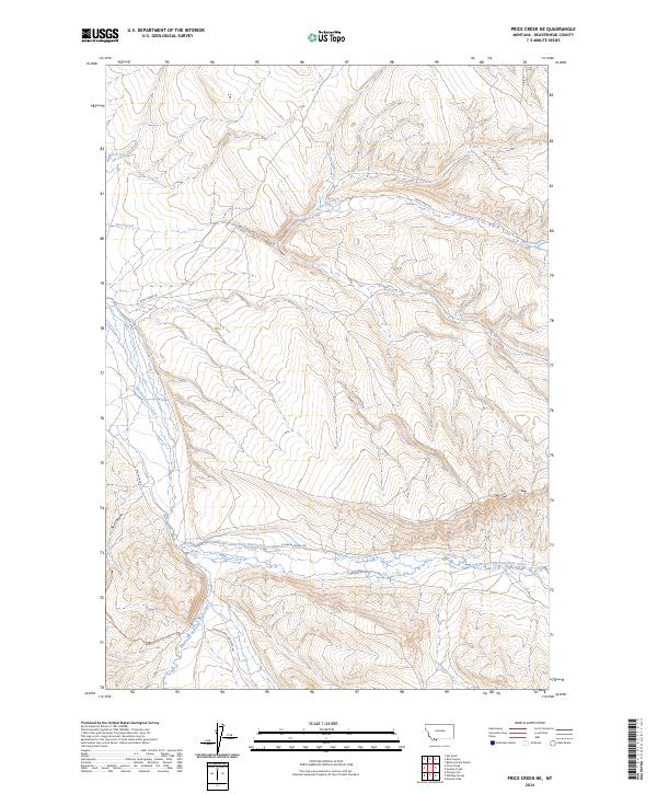
2024 Map of Price Creek NE
USGS Topo · Published 2024About this map
Belmont Park Ranch sits at the heart of this high-elevation landscape in Beaverhead County, where the topography is defined by the convergence of several major drainage systems. The map illustrates the hydrological importance of the Blacktail Deer Creek basin, showing where the East Fork Blacktail Deer Creek and West Fork Blacktail Deer Creek meet to form the main channel. This area is traversed by a network of ranching and land-management routes, including Rock Creek Rd and Middle Fork Blacktail Rd. The terrain is marked by significant features like Red Canyon and the winding course of Rock Creek to the north. These labels reflect the long-standing livestock and watershed management patterns characteristic of this part of Montana, providing a clear view of the rural infrastructure and named watercourses that have served the region for decades.
Find a feature on this map
16 named features on this map. Tap any name to fly to it.
Don’t see what you’re looking for? This feature index may not catch every label — zoom into the map to look around manually.
Map Details
Editions of this 2024 Price Creek NE Map
This is the sole edition of this map. No revisions or reprints were ever made.
Other maps of this area

1893 · Dillon
USGS Topo · 1:250,000

1955 · Dubois
USGS Topo · 1:250,000

1955 · Dillon
USGS Topo · 1:250,000

1957 · Dillon
USGS Topo · 1:250,000

1958 · Dubois
USGS Topo · 1:250,000

1958 · Dillon
USGS Topo · 1:250,000

1961 · Red Canyon
USGS Topo · 1:24,000

1961 · Elk Gulch
USGS Topo · 1:24,000

1962 · Dillon
USGS Topo · 1:250,000
1963 · Belmont Park Ranch
USGS Topo · 1:24,000