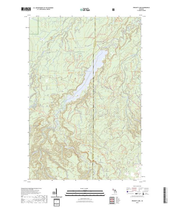
2023 Map of Prickett Lake
USGS Topo · Published 2023About this map
Sturgeon River Gorge Wilderness and the surrounding reaches of the Ottawa National Forest define this landscape along the border of Houghton and Baraga counties. The terrain is deeply influenced by the north-flowing Sturgeon River, which descends through Sturgeon Falls before widening into Prickett Lake. This watercourse, protected as part of the Sturgeon Wild and Scenic River, is supported by a network of tributaries including the Silver River, Little Silver River, and Coach Creek.
Find a feature on this map
44 named features on this map. Tap any name to fly to it.
Don’t see what you’re looking for? This feature index may not catch every label — zoom into the map to look around manually.
Map Details
Editions of this 2023 Prickett Lake Map
This is the sole edition of this map. No revisions or reprints were ever made.
Other maps of this area

1954 · Rousseau
USGS Topo · 1:62,500

1954 · Pelkie
USGS Topo · 1:62,500

1954 · Winona
USGS Topo · 1:62,500

1954 · Sidnaw
USGS Topo · 1:62,500

1958 · Iron River
USGS Topo · 1:250,000

1960 · Iron River
USGS Topo · 1:250,000

1961 · Iron River
USGS Topo · 1:250,000

1967 · Iron River
USGS Topo · 1:250,000
1982 · Nisula
USGS Topo · 1:25,000
1982 · Echo Lake
USGS Topo · 1:25,000