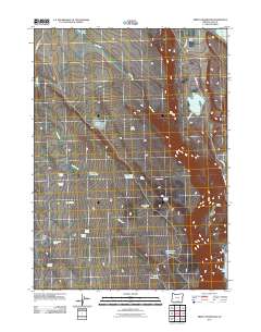
2011 Map of Priday Reservoir
USGS Topo · Published 2011About this map
Priday Reservoir and the expansive drainage of Fish Creek define this section of Lake County, where water resources are the primary landmarks in an arid landscape. The area is characterized by a high concentration of spring-fed waterholes and small lakes, reflecting the critical importance of these features for land use at the Barry Ranch and across the broader territory. Named water sources such as Good Seep Waterhole, Lassie Waterhole, and Sidewinder Waterhole are scattered throughout the region, particularly surrounding Monument Flat. To the east and north, the margins of Crump Lake and Hart Lake provide further evidence of the complex hydrology that supports this high-desert environment. Navigational markers like Hogback Rd and County Hwy 3-13 provide the main corridors of movement through this terrain, connecting remote ranching locations with the wider region.
Find a feature on this map
27 named features on this map. Tap any name to fly to it.
Don’t see what you’re looking for? This feature index may not catch every label — zoom into the map to look around manually.
Map Details
Editions of this 2011 Priday Reservoir Map
This is the sole edition of this map. No revisions or reprints were ever made.
Other maps of this area

1955 · Klamath Falls
USGS Topo · 1:250,000

1955 · Adel
USGS Topo · 1:250,000

1957 · Adel
USGS Topo · 1:250,000

1958 · Klamath Falls
USGS Topo · 1:250,000

1958 · Adel
USGS Topo · 1:250,000

1962 · Adel
USGS Topo · 1:250,000

1967 · Plush
USGS Topo · 1:24,000

1967 · Priday Reservoir
USGS Topo · 1:24,000

1967 · Hart Lake
USGS Topo · 1:24,000

1967 · Crump Lake
USGS Topo · 1:24,000