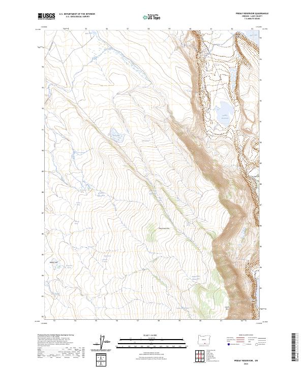
2024 Map of Priday Reservoir
USGS Topo · Published 2024About this map
Warner Valley and the steep eastern escarpment of Lynchs Rim define the character of this arid landscape in Lake County. The map details a high-desert environment where water sources are vital, ranging from substantial bodies like Priday Reservoir and Hart Lake to numerous named springs and livestock improvements. Named features like Sidewinder Waterhole, Lassie Waterhole, and Good Seep Waterhole underscore the necessity of water management for ranching and wildlife in the high basin.
Find a feature on this map
33 named features on this map. Tap any name to fly to it.
Don’t see what you’re looking for? This feature index may not catch every label — zoom into the map to look around manually.
Map Details
Editions of this 2024 Priday Reservoir Map
This is the sole edition of this map. No revisions or reprints were ever made.
Other maps of this area

1955 · Klamath Falls
USGS Topo · 1:250,000

1955 · Adel
USGS Topo · 1:250,000

1957 · Adel
USGS Topo · 1:250,000

1958 · Klamath Falls
USGS Topo · 1:250,000

1958 · Adel
USGS Topo · 1:250,000

1962 · Adel
USGS Topo · 1:250,000

1967 · Plush
USGS Topo · 1:24,000

1967 · Priday Reservoir
USGS Topo · 1:24,000

1967 · Hart Lake
USGS Topo · 1:24,000

1967 · Crump Lake
USGS Topo · 1:24,000