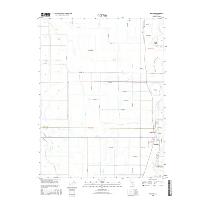
2015 Map of Princeton
USGS Topo · Published 2015About this map
The Sacramento River meanders along the eastern edge of this landscape, defining the border between Glenn Co and Colusa Co. The settlement of Princeton anchors the southern riverbend, while Codora sits further north along the River Br Canal. This portion of the Sacramento Valley is a complex network of water management and irrigation, featuring the Provident Central Canal, Central Drain, and Provident Eastern Canal that support the surrounding agricultural lands.
Find a feature on this map
59 named features on this map. Tap any name to fly to it.
Don’t see what you’re looking for? This feature index may not catch every label — zoom into the map to look around manually.
Map Details
Editions of this 2015 Princeton Map
This is the sole edition of this map. No revisions or reprints were ever made.
Other maps of this area

1888 · Marysville
USGS Topo · 1:125,000

1891 · Chico
USGS Topo · 1:125,000

1891 · Marysville
USGS Topo · 1:125,000

1893 · Chico
USGS Topo · 1:125,000

1894 · Marysville
USGS Topo · 1:125,000

1895 · Marysville
USGS Topo · 1:125,000

1895 · Chico
USGS Topo · 1:125,000

1906 · Maxwell
USGS Topo · 1:62,500

1906 · Willows
USGS Topo · 1:62,500

1911 · Sanborn Slough
USGS Topo · 1:31,680