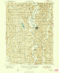
1948 Map of Princeton
USGS Topo · Published 1948About this map
The Weldon River carves a central path through this mid-century portrait of Mercer County, anchoring the town of Princeton. The landscape is a dense network of early rural education and faith, dotted with dozens of named schoolhouses like West High Point Sch and Franklin Sch, alongside local landmarks such as the County Home. The industrial and transport backbone of the era is defined by the Chicago Rock Island and Pacific railroad, which follows the river valley through settlements like Mill Grove. Significant water features, including the man-made Lake Paho and the curious Ballast Pit Lake, reflect the region's mid-century development. Genealogists will find a wealth of specific data points in the many family-named burial grounds, such as Salem Cem and Underwood Cem, which provide a clear record of the area's established farming communities during the post-war years.
Find a feature on this map
84 named features on this map. Tap any name to fly to it.
Don’t see what you’re looking for? This feature index may not catch every label — zoom into the map to look around manually.
Map Details
Editions of this 1948 Princeton Map
2 editions found
Other maps of this area

1925 · Gilman
USGS Topo · 1:62,500

1945 · Lamoni
USGS Topo · 1:62,500

1946 · Gilman
USGS Topo · 1:48,000

1946 · Princeton
USGS Topo · 1:62,500

1946 · Galt
USGS Topo · 1:62,500

1947 · Lamoni
USGS Topo · 1:62,500

1947 · Blythedale
USGS Topo · 1:62,500

1948 · Gilman
USGS Topo · 1:62,500

1948 · Princeton
USGS Topo · 1:62,500

1948 · Trenton
USGS Topo · 1:62,500