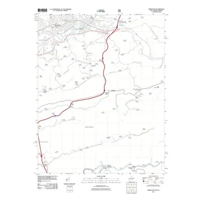
2011 Map of Princeton
USGS Topo · Published 2011About this map
Princeton serves as the focal point of this Mercer County survey, showcasing a dense network of residential streets and civic landmarks like the Princeton Post Office. To the south, the landscape is defined by the massive East River Mountain ridge, famously pierced by the East River Mountain Tunnel. The surrounding valleys are marked by a high density of small family and community burial grounds, including Oakwood Cemetery, Resthaven Cemetery, and Mills Cemetery, which provide a detailed record of the area's genealogical history.
Find a feature on this map
122 named features on this map. Tap any name to fly to it.
Don’t see what you’re looking for? This feature index may not catch every label — zoom into the map to look around manually.
Map Details
Editions of this 2011 Princeton Map
This is the sole edition of this map. No revisions or reprints were ever made.
Other maps of this area

1887 · Pocahontas
USGS Topo · 1:125,000

1890 · Dublin
USGS Topo · 1:125,000

1891 · Pocahontas
USGS Topo · 1:125,000

1891 · Dublin
USGS Topo · 1:125,000

1894 · Pocahontas
USGS Topo · 1:125,000

1895 · Pocahontas
USGS Topo · 1:125,000

1913 · Peterstown
USGS Topo · 1:48,000

1913 · Bluefield
USGS Topo · 1:48,000

1916 · Bluefield
USGS Topo · 1:62,500

1916 · Peterstown
USGS Topo · 1:62,500