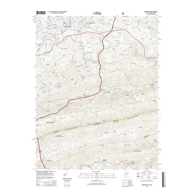
2014 Map of Princeton
USGS Topo · Published 2014About this map
Princeton and Bluefield anchor this topographic view of the West Virginia and Virginia border, where the Norfolk and Western railway and Us-460 navigate the complex corridors of the Appalachian landscape. The terrain is defined by the massive ridge of E River Mtn, which is pierced by the East River Mountain Tunnel, a critical transport link near the state line. Numerous family cemeteries and small valley settlements like Lilly Grove, Stumpy Bottom, and Spangler Valley are tucked into the drainages of Brush Cr and East River. The southern portion of the sheet transitions into the protected lands of the Jefferson National Forest, where high elevations like Buckhorn Mtn and Wolf Creek Mtn overlook deeply cut hollows such as Opossum Hollow and Lambert Hollow. This map traces a network of rural schools and churches, including the Elmore School and Mt Horeb Cem, reflecting the persistent settlement patterns in this mountain region.
Find a feature on this map
104 named features on this map. Tap any name to fly to it.
Don’t see what you’re looking for? This feature index may not catch every label — zoom into the map to look around manually.
Map Details
Editions of this 2014 Princeton Map
This is the sole edition of this map. No revisions or reprints were ever made.
Other maps of this area

1887 · Pocahontas
USGS Topo · 1:125,000

1890 · Dublin
USGS Topo · 1:125,000

1891 · Pocahontas
USGS Topo · 1:125,000

1891 · Dublin
USGS Topo · 1:125,000

1894 · Pocahontas
USGS Topo · 1:125,000

1895 · Pocahontas
USGS Topo · 1:125,000

1913 · Peterstown
USGS Topo · 1:48,000

1913 · Bluefield
USGS Topo · 1:48,000

1916 · Bluefield
USGS Topo · 1:62,500

1916 · Peterstown
USGS Topo · 1:62,500