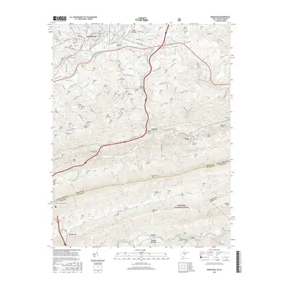
2016 Map of Princeton
USGS Topo · Published 2016About this map
Princeton and its surrounding communities sit at a busy crossroads where the Appalachian heights meet the valleys of the East River. The landscape is defined by the sharp ridgeline of East River Mountain, which serves as a natural boundary between Mercer and Bland counties and the states of West Virginia and Virginia. A significant engineering landmark, the East River Mountain Tunnel, facilitates passage through this steep terrain, connecting the high country of the Jefferson National Forest to the urban center.
Find a feature on this map
111 named features on this map. Tap any name to fly to it.
Don’t see what you’re looking for? This feature index may not catch every label — zoom into the map to look around manually.
Map Details
Editions of this 2016 Princeton Map
This is the sole edition of this map. No revisions or reprints were ever made.
Other maps of this area

1887 · Pocahontas
USGS Topo · 1:125,000

1890 · Dublin
USGS Topo · 1:125,000

1891 · Pocahontas
USGS Topo · 1:125,000

1891 · Dublin
USGS Topo · 1:125,000

1894 · Pocahontas
USGS Topo · 1:125,000

1895 · Pocahontas
USGS Topo · 1:125,000

1913 · Peterstown
USGS Topo · 1:48,000

1913 · Bluefield
USGS Topo · 1:48,000

1916 · Bluefield
USGS Topo · 1:62,500

1916 · Peterstown
USGS Topo · 1:62,500