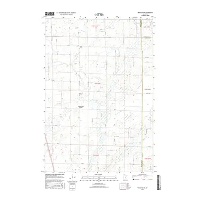
2016 Map of Princeton NE
USGS Topo · Published 2016About this map
The Rum River meanders through this section of central Minnesota, defining a landscape shaped by glacial watercourses and late-period rural development. In the heart of Bogus Brook, the small settlement of Woodward Brook sits at a crossroads, serving as a focal point for the surrounding farmsteads. The area is intersected by a grid of county roads and township lines, reflecting the organized agricultural layout of Mille Lacs County.
Find a feature on this map
66 named features on this map. Tap any name to fly to it.
Don’t see what you’re looking for? This feature index may not catch every label — zoom into the map to look around manually.
Map Details
Editions of this 2016 Princeton NE Map
This is the sole edition of this map. No revisions or reprints were ever made.
Other maps of this area

1953 · Stillwater
USGS Topo · 1:250,000

1955 · Stillwater
USGS Topo · 1:250,000

1958 · Stillwater
USGS Topo · 1:250,000

1961 · Dalbo
USGS Topo · 1:24,000

1961 · Wyanett
USGS Topo · 1:24,000

1961 · Dalbo
USGS Topo · 1:62,500

1965 · Stillwater
USGS Topo · 1:250,000
1968 · Princeton SW
USGS Topo · 1:24,000

1968 · Milaca
USGS Topo · 1:24,000
1968 · Princeton
USGS Topo · 1:24,000
Featured Places
- Bogus Brook Township, MN
- Wyanett Township, MN
- Dalbo Township, MN
- Borgholm Township, MN
- Princeton Township, MN