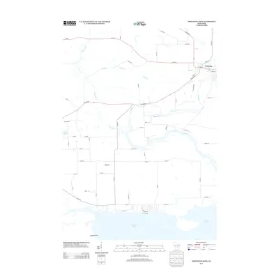
2013 Map of Princeton West
USGS Topo · Published 2013About this map
Puckaway Lake and its northern marshlands dominate the southern landscape of this Green Lake County survey, where the Mecan River flows through the township of Mecan before joining the Fox River. The topography is defined by the complex water system near the city of Princeton, notably the prominent Mill Race and Canal St that reflect early industrial and transportation adaptations to the river's path. In the western portion, White Lake and the meandering river loops suggest a wetland-heavy terrain that has influenced local road placement, such as Co Hwy-C and State Road 23. The presence of Haystack Point on the shores of Puckaway Lake provides a specific landmark for those tracing 21st-century shorelines or local land-use patterns in this part of Wisconsin.
Find a feature on this map
57 named features on this map. Tap any name to fly to it.
Don’t see what you’re looking for? This feature index may not catch every label — zoom into the map to look around manually.
Map Details
Editions of this 2013 Princeton West Map
This is the sole edition of this map. No revisions or reprints were ever made.
Other maps of this area

1902 · Portage
USGS Topo · 1:62,500

1915 · Neshkoro
USGS Topo · 1:48,000

1918 · Neshkoro
USGS Topo · 1:62,500

1955 · Randolph
USGS Topo · 1:62,500

1957 · Madison
USGS Topo · 1:250,000

1960 · Madison
USGS Topo · 1:250,000

1961 · Montello
USGS Topo · 1:62,500

1962 · Portage
USGS Topo · 1:62,500

1963 · Neshkoro
USGS Topo · 1:62,500
1980 · Manchester
USGS Topo · 1:24,000