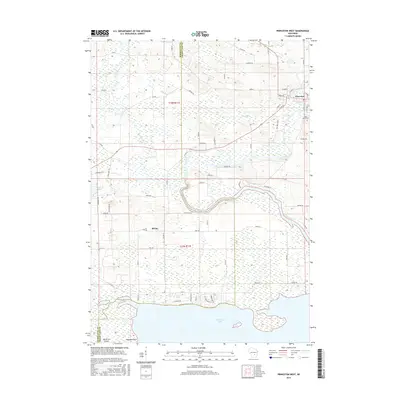
2016 Map of Princeton West
USGS Topo · Published 2016About this map
Princeton occupies the northeastern corner of this survey, situated where the Fox River makes a sharp bend toward the east. The landscape is defined by the complex hydrology of the region, where the river system meanders through low-lying terrain characterized by extensive wetlands and large water bodies like White Lake and the northern reaches of Puckaway Lake. A local landmark, the Saint Johns Cem, is located just south of the main settlement along Cradle Rd, providing a specific point of interest for those tracing local lineages.
Find a feature on this map
69 named features on this map. Tap any name to fly to it.
Don’t see what you’re looking for? This feature index may not catch every label — zoom into the map to look around manually.
Map Details
Editions of this 2016 Princeton West Map
This is the sole edition of this map. No revisions or reprints were ever made.
Other maps of this area

1902 · Portage
USGS Topo · 1:62,500

1915 · Neshkoro
USGS Topo · 1:48,000

1918 · Neshkoro
USGS Topo · 1:62,500

1955 · Randolph
USGS Topo · 1:62,500

1957 · Madison
USGS Topo · 1:250,000

1960 · Madison
USGS Topo · 1:250,000

1961 · Montello
USGS Topo · 1:62,500

1962 · Portage
USGS Topo · 1:62,500

1963 · Neshkoro
USGS Topo · 1:62,500
1980 · Manchester
USGS Topo · 1:24,000