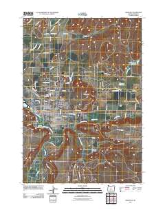
2011 Map of Prineville
USGS Topo · Published 2011About this map
Prineville sits at the confluence of the Crooked River and Ochoco Creek, serving as the heart of Crook County's agricultural and transit network. This 2011 survey illustrates a community shaped by its water management, where the Ochoco Main Canal, Ochoco Distribution Canal, and the Peoples Irrigation Company Ditch branch out to support the surrounding high desert terrain. The map details the transition from the city's civic core, featuring the Prineville Post Office and Crook County Fairgrounds, to the rugged geography of Barnes Butte and Combs Flat. To the north and east, several water storage sites including Barnes Butte Reservoir, Johnson Creek Reservoir, and Crawford Reservoir underline the critical role of irrigation in the local landscape. Farther out, landmarks such as Juniper Haven Cemetery, Tallwheel Airport, and the Breese Ranch offer specific points of interest for genealogists and local historians tracking family roots and property boundaries in this part of Central Oregon.
Find a feature on this map
72 named features on this map. Tap any name to fly to it.
Don’t see what you’re looking for? This feature index may not catch every label — zoom into the map to look around manually.
Map Details
Editions of this 2011 Prineville Map
This is the sole edition of this map. No revisions or reprints were ever made.
Other maps of this area

1946 · Eagle Rock
USGS Topo · 1:62,500

1948 · Eagle Rock
USGS Topo · 1:62,500

1948 · Ochoco Reservoir
USGS Topo · 1:62,500

1950 · Ochoco Reservoir
USGS Topo · 1:62,500

1955 · Bend
USGS Topo · 1:250,000

1957 · Bend
USGS Topo · 1:250,000

1958 · Bend
USGS Topo · 1:250,000

1962 · Huston Lake
USGS Topo · 1:24,000

1962 · Prineville
USGS Topo · 1:24,000

1962 · Powell Buttes
USGS Topo · 1:62,500