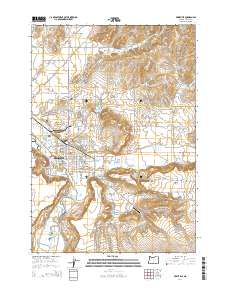
2014 Map of Prineville
USGS Topo · Published 2014About this map
Prineville sits at the confluence of Ochoco Cr and the Crooked River, serving as the central hub of the Prineville Valley. The landscape is defined by the transition from irrigated valley floors to higher plateaus, evidenced by the complex network of water management features like the Ochoco Main Canal and Peoples Irrigation Company Ditch. These waterways support the agricultural character of the region while skirting the prominent geological feature of Barnes Butte.
Find a feature on this map
106 named features on this map. Tap any name to fly to it.
Don’t see what you’re looking for? This feature index may not catch every label — zoom into the map to look around manually.
Map Details
Editions of this 2014 Prineville Map
This is the sole edition of this map. No revisions or reprints were ever made.
Other maps of this area

1946 · Eagle Rock
USGS Topo · 1:62,500

1948 · Eagle Rock
USGS Topo · 1:62,500

1948 · Ochoco Reservoir
USGS Topo · 1:62,500

1950 · Ochoco Reservoir
USGS Topo · 1:62,500

1955 · Bend
USGS Topo · 1:250,000

1957 · Bend
USGS Topo · 1:250,000

1958 · Bend
USGS Topo · 1:250,000

1962 · Huston Lake
USGS Topo · 1:24,000

1962 · Prineville
USGS Topo · 1:24,000

1962 · Powell Buttes
USGS Topo · 1:62,500