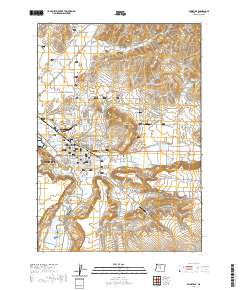
2020 Map of Prineville
USGS Topo · Published 2020About this map
The city of Prineville sits at the confluence of several vital water systems, where the Crooked River meets Ochoco Creek and McKay Creek. This recent survey reveals the sophisticated hydraulic infrastructure of the Prineville Valley, defined by the Ochoco Main Canal, Ochoco Distribution Canal, and historic irrigation works like Stearns Ditch and Ryegrass Ditch. These waterways support the agricultural character of the region while framing the city's modern expansion toward Juniper Canyon.
Find a feature on this map
94 named features on this map. Tap any name to fly to it.
Don’t see what you’re looking for? This feature index may not catch every label — zoom into the map to look around manually.
Map Details
Editions of this 2020 Prineville Map
This is the sole edition of this map. No revisions or reprints were ever made.
Other maps of this area

1946 · Eagle Rock
USGS Topo · 1:62,500

1948 · Eagle Rock
USGS Topo · 1:62,500

1948 · Ochoco Reservoir
USGS Topo · 1:62,500

1950 · Ochoco Reservoir
USGS Topo · 1:62,500

1955 · Bend
USGS Topo · 1:250,000

1957 · Bend
USGS Topo · 1:250,000

1958 · Bend
USGS Topo · 1:250,000

1962 · Huston Lake
USGS Topo · 1:24,000

1962 · Prineville
USGS Topo · 1:24,000

1962 · Powell Buttes
USGS Topo · 1:62,500