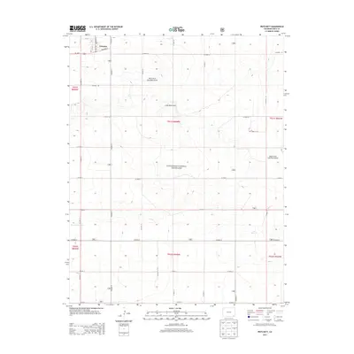
2013 Map of Pritchett
USGS Topo · Published 2013About this map
Pritchett occupies the northwest corner of this map, established where US Hwy 160 meets local ways like Railroad St and Irving St. The surrounding landscape is defined by the sweeping reach of the Comanche National Grassland, a vast public expanse that preserves the shortgrass prairie of the high plains. The topography is shaped by the intermittent drainage of Lone Rock Draw and its tributaries, including the North Fork and South Fork. These natural contours are punctuated by small-scale water management features typical of the arid region, such as Jett Reservoir and Tract 1828 Reservoir. A rigid grid of county roads, such as Co Road 13 and Co Road W, overlays the terrain, reflecting the systematic land division and ranching access routes that support the area's agricultural community.
Find a feature on this map
74 named features on this map. Tap any name to fly to it.
Don’t see what you’re looking for? This feature index may not catch every label — zoom into the map to look around manually.
Map Details
Editions of this 2013 Pritchett Map
This is the sole edition of this map. No revisions or reprints were ever made.
Other maps of this area

1891 · Springfield
USGS Topo · 1:125,000

1893 · Springfield
USGS Topo · 1:125,000

1955 · La Junta
USGS Topo · 1:250,000

1958 · La Junta
USGS Topo · 1:250,000

1968 · La Junta
USGS Topo · 1:250,000

1978 · Edler
USGS Topo · 1:24,000

1978 · Pritchett
USGS Topo · 1:24,000

1978 · Springfield SW
USGS Topo · 1:24,000
1978 · Harbord
USGS Topo · 1:24,000
1978 · Lone Rock
USGS Topo · 1:24,000