2022 Map of Pritchett
USGS Topo · Published 2022About this map
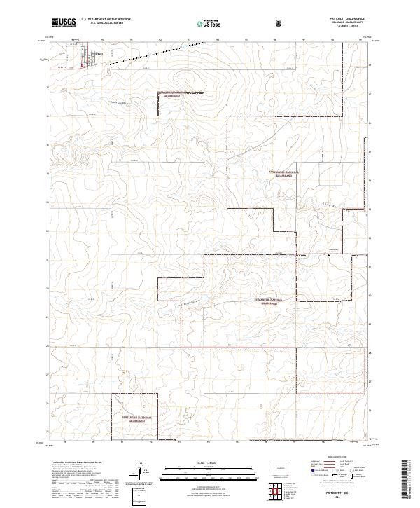
Pritchett anchors this corner of Baca County, where the street grid of Howard St and Adams St meets the open expanses of the Comanche National Grassland. The landscape is defined by the dendritic drainage patterns of the Lone Rock Draw, with its north and south forks carving through the high plains. A significant local landmark for genealogists and historians is the Old Number Two Cemetery, located in the eastern portion of the quadrangle near Co Rd Y. The mapping of these ephemeral watercourses, including Cat Creek in the north, illustrates the vital role of drainage in this semi-arid ranching and conservation environment. The intersection of section-line roads and federal grassland boundaries reveals a complex pattern of public and private land use typical of the Colorado plains.
Find a feature on this map
32 named features on this map. Tap any name to fly to it.
Don’t see what you’re looking for? This feature index may not catch every label — zoom into the map to look around manually.
Map Details
Editions of this 2022 Pritchett Map
This is the sole edition of this map. No revisions or reprints were ever made.