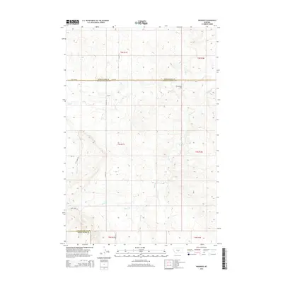
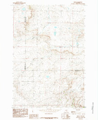
2014 Map of Progress
USGS Topo · Published 2014About this map
The settlement of Progress anchors this Central Montana landscape at the crossroads of S Shamut Rd and Tony Creek Rd. Positioned along the divide between Wheatland, Golden Valley, and Sweet Grass Counties, this area is defined by a dendritic network of drainages including Fish Creek and Simmons Creek. The terrain is characterized by gradual elevation shifts, culminating in local landmarks such as Chinamans Hat. Historical land use is evidenced by established routes like Titeca Ranch Ln and Cherry Creek Rd, which provide access through the complex township and range sections. The map preserves the spatial arrangement of rural Montana just as modernization of the county line corridors was being documented, showing how these remote watercourses like Andrews Creek and Cherry Creek influenced the placement of early ranching infrastructure.
Find a feature on this map
21 named features on this map. Tap any name to fly to it.
Don’t see what you’re looking for? This feature index may not catch every label — zoom into the map to look around manually.
Map Details
Editions of this 2014 Progress Map
This is the sole edition of this map. No revisions or reprints were ever made.
Other maps of this area

1889 · Big Snowy Mountain
USGS Topo · 1:250,000

1893 · Big Snowy Mountain
USGS Topo · 1:250,000

1954 · Roundup
USGS Topo · 1:250,000

1958 · Roundup
USGS Topo · 1:250,000

1985 · Jim Creek
USGS Topo · 1:24,000
1985 · Locomotive Butte SW
USGS Topo · 1:24,000

1985 · Progress
USGS Topo · 1:24,000
1985 · Gibson SW
USGS Topo · 1:24,000
1985 · O'Brien Hill
USGS Topo · 1:24,000
1985 · Gibson
USGS Topo · 1:24,000