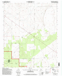
1995 Map of Progresso NE
USGS Topo · Published 1998About this map
Gustins Ranch and McGoragill Ranch anchor this mid-1990s survey of Torrance County, New Mexico, illustrating a landscape defined by isolated ranching outposts and high-desert water management. The terrain is marked by significant topographical relief, most notably at Blanco Cañon, where the land drops away toward the southwest corner of the map. Much of the southern portion falls within the Cibola National Forest, showing a distinct transition from open range to protected forest land.
Find a feature on this map
13 named features on this map. Tap any name to fly to it.
Don’t see what you’re looking for? This feature index may not catch every label — zoom into the map to look around manually.
Map Details
Editions of this 1995 Progresso NE Map
This is the sole edition of this map. No revisions or reprints were ever made.
Other maps of this area

1954 · Fort Sumner
USGS Topo · 1:250,000

1958 · Fort Sumner
USGS Topo · 1:250,000

1978 · Negra SW
USGS Topo · 1:24,000

1978 · Laguna Del Perro South
USGS Topo · 1:24,000

1978 · Rattlesnake Hill
USGS Topo · 1:24,000

1980 · Corona
USGS Topo · 1:100,000

1981 · Progresso NE
USGS Topo · 1:24,000

1981 · Pino Mountain
USGS Topo · 1:24,000
1981 · Progresso SW
USGS Topo · 1:24,000
1981 · Progresso
USGS Topo · 1:24,000