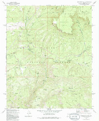
1973 Map of Promontory Butte
USGS Topo · Published 1986About this map
The dramatic precipice of the Mogollon Rim dominates this 1973 survey, marking the topographical boundary between the high plateau of Sitgreaves National Forest and the canyons of Tonto National Forest. Settlement in this transition zone centers on established cattle operations and recreation, featuring names like Kohls Ranch, Winters Ranch, and the Wipala Wiki Ranch. The landscape is etched with a network of resource-management infrastructure, from the Lookout Tower Promontory to various water-gathering points such as Bearhide Spring and Mescal Ridge Tank.
Find a feature on this map
61 named features on this map. Tap any name to fly to it.
Don’t see what you’re looking for? This feature index may not catch every label — zoom into the map to look around manually.
Map Details
Editions of this 1973 Promontory Butte Map
4 editions found
Other maps of this area

1886 · Holbrook
USGS Topo · 1:250,000

1887 · Verde
USGS Topo · 1:250,000

1892 · Verde
USGS Topo · 1:250,000

1893 · Holbrook
USGS Topo · 1:250,000

1934 · Promontory Butte
USGS Topo · 1:62,500

1937 · Diamond Butte
USGS Topo · 1:48,000

1939 · Promontory Butte
USGS Topo · 1:62,500

1943 · Diamond Butte
USGS Topo · 1:62,500

1952 · Promontory Butte
USGS Topo · 1:62,500

1954 · Holbrook
USGS Topo · 1:250,000
Featured Places
- Thompson Draw Summer Homes Unit #1, AZ
- Tonto Estate, AZ
- Hunter Creek, AZ
- Bear Flat, AZ
- Christopher Creek, AZ