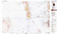
1987 Map of Promontory Point
USGS Topo · Published 1987About this map
Great Salt Lake dominates this 1980s landscape, illustrating the engineering of the Southern Pacific (Lucin Cutoff) as it strikes west across the water from Promontory Point. The map details the transition from the industrial and military corridors of the Wasatch Front to the remote islands and mudflats of the west. Large-scale salt evaporators and conservation areas like the Bear River Migratory Bird Refuge highlight the specialized land use surrounding the saline waters. On the eastern shore, a dense network of towns including Brigham City, Clearfield, and Layton sit alongside Hill Air Force Base, showing the suburban and military expansion of the era. The presence of the Union Pacific and Denver and Rio Grande Western railroads underscores the region's importance as a continental transit hub, while isolated stations like Midlake and Tresend mark the lonely path of the rail line over the lake.
Find a feature on this map
73 named features on this map. Tap any name to fly to it.
Don’t see what you’re looking for? This feature index may not catch every label — zoom into the map to look around manually.
Map Details
Editions of this 1987 Promontory Point Map
This is the sole edition of this map. No revisions or reprints were ever made.
Other maps of this area

1885 · Salt Lake
USGS Topo · 1:250,000

1885 · Tooele Valley
USGS Topo · 1:250,000

1914 · Logan
USGS Topo · 1:125,000

1916 · Logan
USGS Topo · 1:125,000

1925 · Ft. Douglas
USGS Topo · 1:125,000

1928 · Ft. Douglas
USGS Topo · 1:125,000

1952 · Saltair NE
USGS Topo · 1:24,000

1952 · Farmington
USGS Topo · 1:24,000

1953 · Tooele
USGS Topo · 1:250,000

1954 · Whistler Canal
USGS Topo · 1:24,000