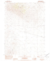
1982 Map of Pronto
USGS Topo · Published 1982About this map
Blue Mountain dominates the northern skyline of this Nevada landscape, transitioning from high peaks down toward the desert flats where the Southern Pacific railroad runs through the small settlement of Pronto. This 1982 provisional survey captures a region defined by its industrial and natural landmarks, where mineral exploration is evidenced by the Atlas Mine and various prospect locations. Water sources are scarce but critical in this arid environment, noted by the presence of Sampson Spring and O'Donnell Spring tucked into the mountain folds.
Find a feature on this map
16 named features on this map. Tap any name to fly to it.
Don’t see what you’re looking for? This feature index may not catch every label — zoom into the map to look around manually.
Map Details
Editions of this 1982 Pronto Map
This is the sole edition of this map. No revisions or reprints were ever made.
Other maps of this area

1882 · Paradise
USGS Topo · 1:250,000

1886 · Disaster
USGS Topo · 1:250,000

1893 · Paradise
USGS Topo · 1:250,000

1893 · Disaster
USGS Topo · 1:250,000

1931 · Lovelock
USGS Topo · 1:250,000

1932 · Sonoma Range
USGS Topo · 1:250,000

1935 · Lovelock
USGS Topo · 1:250,000

1939 · Sonoma Range
USGS Topo · 1:250,000

1939 · Eugene Mountains Area
USGS Topo · 1:62,500

1942 · Eugene Mountains Area
USGS Topo · 1:62,500