
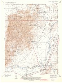
1942 Map of Eugene Mountains Area
USGS Topo · Published 1942About this map
Mining operations and transportation corridors dominate this Great Basin landscape during the early 1940s. The Eugene Mountains rise sharply in the center of the sheet, hosting industrial sites like the Nevada Massachusetts Tungsten Mine and the Golden Eagle Mine. To the east and south, the Humboldt River carves a fertile path through the desert, supporting ranching outposts such as Thackers Ranch and providing the route for the Southern Pacific railroad. A striking layer of history is visible in the overlapping travel routes, where the Emigrant Trail and Old Stage Road run parallel to the modern Victory Highway. Local life is anchored at Imlay and Mill City, where a Diversion Canal and Gaging Station indicate the critical management of water in this arid Nevada terrain.
Find a feature on this map
38 named features on this map. Tap any name to fly to it.
Don’t see what you’re looking for? This feature index may not catch every label — zoom into the map to look around manually.
Map Details
Editions of this 1942 Eugene Mountains Area Map
2 editions found
Other maps of this area

1931 · Lovelock
USGS Topo · 1:250,000

1932 · Sonoma Range
USGS Topo · 1:250,000

1935 · Lovelock
USGS Topo · 1:250,000

1939 · Sonoma Range
USGS Topo · 1:250,000

1939 · Eugene Mountains Area
USGS Topo · 1:62,500

1955 · Lovelock
USGS Topo · 1:250,000

1955 · Winnemucca
USGS Topo · 1:250,000

1956 · Imlay
USGS Topo · 1:62,500

1958 · Winnemucca
USGS Topo · 1:250,000

1958 · Rose Creek
USGS Topo · 1:62,500