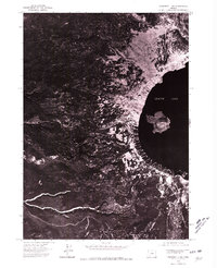
1975 Map of Prospect 1 NW
USGS Topo · Published 1980About this map
Crater Lake dominates the eastern half of this 1975 aerial perspective, revealing the stark contrast between the deep volcanic waters and the surrounding high-elevation terrain. The volcanic cone of Wizard Island stands prominently near the western shore, while the rim's infrastructure is represented by the Rim Village Campground. This orthophotoquad captures the landscape at a specific moment in the mid-1970s, showing the dense timber and drainage patterns of the western slopes leading toward Munson Ridge. To the south, the deep incision of Castle Creek carves through the forest, providing a clear look at the geological drainage system away from the caldera rim before modern environmental changes or significant infrastructure expansions altered the local footprint.
Find a feature on this map
5 named features on this map. Tap any name to fly to it.
Don’t see what you’re looking for? This feature index may not catch every label — zoom into the map to look around manually.
Map Details
Editions of this 1975 Prospect 1 NW Map
This is the sole edition of this map. No revisions or reprints were ever made.
Other maps of this area

1891 · Ashland
USGS Topo · 1:250,000

1893 · Ashland
USGS Topo · 1:250,000

1897 · Ashland
USGS Topo · 1:250,000

1917 · Diamond Lake
USGS Topo · 1:125,000

1955 · Medford
USGS Topo · 1:250,000

1956 · Diamond Lake
USGS Topo · 1:62,500

1956 · Garwood Butte
USGS Topo · 1:62,500

1956 · Prospect
USGS Topo · 1:62,500

1957 · Medford
USGS Topo · 1:250,000

1958 · Medford
USGS Topo · 1:250,000