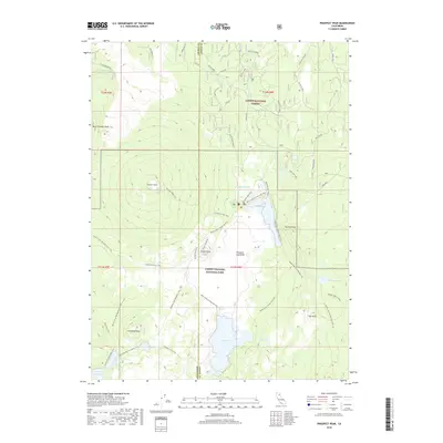
2018 Map of Prospect Peak
USGS Topo · Published 2018About this map
The geological force of the southern Cascades is evident across this portion of Lassen Volcanic National Park, where the towering Prospect Peak and West Prospect Peak dominate the northern terrain. The landscape is defined by volcanic activity, most notably at the Cinder Cone and the expansive Fantastic Lava Beds, which spill toward the shores of Butte Lake. This 2018 survey captures the intersection of natural history and human movement, recording the historic Nobles Emigrant Trail as it crosses the park south of Sunrise Peak.
Find a feature on this map
36 named features on this map. Tap any name to fly to it.
Don’t see what you’re looking for? This feature index may not catch every label — zoom into the map to look around manually.
Map Details
Editions of this 2018 Prospect Peak Map
This is the sole edition of this map. No revisions or reprints were ever made.
Other maps of this area

1886 · Lassen Peak
USGS Topo · 1:250,000

1892 · Lassen Peak
USGS Topo · 1:250,000

1894 · Lassen Peak
USGS Topo · 1:250,000

1939 · Halls Flat
USGS Topo · 1:125,000

1955 · Westwood
USGS Topo · 1:250,000

1956 · Mt. Harkness
USGS Topo · 1:62,500

1956 · Chester
USGS Topo · 1:62,500

1956 · Harvey Mtn
USGS Topo · 1:62,500

1957 · Prospect Peak
USGS Topo · 1:62,500

1958 · Westwood
USGS Topo · 1:250,000