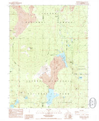
1985 Map of Prospect Peak
USGS Topo · Published 1985About this map
Cinder Cone and the surrounding volcanic terrain dominate this 1980s topographic study of the northeastern corner of Lassen Volcanic National Park. The landscape is defined by the massive Fantastic Lava Beds, a stark basaltic flow that terminates abruptly into the waters of Butte Lake and Snag Lake. Near the cone, the Painted Dunes offer a distinct geological contrast, illustrating the complex eruptive history of the region.
Find a feature on this map
29 named features on this map. Tap any name to fly to it.
Don’t see what you’re looking for? This feature index may not catch every label — zoom into the map to look around manually.
Map Details
Editions of this 1985 Prospect Peak Map
This is the sole edition of this map. No revisions or reprints were ever made.
Other maps of this area

1886 · Lassen Peak
USGS Topo · 1:250,000

1892 · Lassen Peak
USGS Topo · 1:250,000

1894 · Lassen Peak
USGS Topo · 1:250,000

1939 · Halls Flat
USGS Topo · 1:125,000

1955 · Westwood
USGS Topo · 1:250,000

1956 · Mt. Harkness
USGS Topo · 1:62,500

1956 · Chester
USGS Topo · 1:62,500

1956 · Harvey Mtn
USGS Topo · 1:62,500

1957 · Prospect Peak
USGS Topo · 1:62,500

1958 · Westwood
USGS Topo · 1:250,000