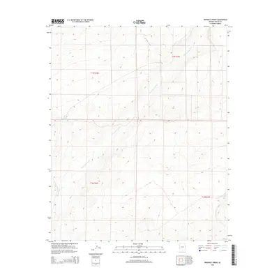
2014 Map of Prospect Spring
USGS Topo · Published 2014About this map
Prospect Spring serves as a lone, critical water point in this arid stretch of Apache County, situated at the base of the high-country contours that define the local relief. The landscape is primarily shaped by the winding path of Hardscrabble Wash, which cuts diagonally across the township lines of t17n r28e, t17n r29e, t16n r28e, and t16n r29e. This 2014 survey documents a territory defined by its drainage patterns rather than dense settlement, offering a clear view of the natural topography in the decades following early ranching and land surveying efforts in the region. The map provides a precise record of the elevation and geographic boundaries within this portion of the Arizona high desert.
Find a feature on this map
6 named features on this map. Tap any name to fly to it.
Don’t see what you’re looking for? This feature index may not catch every label — zoom into the map to look around manually.
Map Details
Editions of this 2014 Prospect Spring Map
This is the sole edition of this map. No revisions or reprints were ever made.
Other maps of this area

1886 · St Johns
USGS Topo · 1:250,000

1892 · St Johns
USGS Topo · 1:250,000

1954 · Saint Johns
USGS Topo · 1:250,000

1955 · Wolford Springs 3 NW
USGS Topo · 1:24,000

1957 · Saint Johns
USGS Topo · 1:250,000

1958 · Saint Johns
USGS Topo · 1:250,000

1962 · Saint Johns
USGS Topo · 1:250,000
1977 · Ceadro Spring
USGS Topo · 1:24,000

1977 · Long H Ranch
USGS Topo · 1:24,000
1978 · Fairchild Well
USGS Topo · 1:24,000