
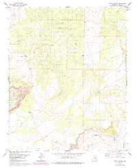
1977 Map of Long H Ranch
USGS Topo · Published 1978About this map
Long H Ranch sits at the heart of this Apache County landscape, characterized by the winding path of Hardscrabble Wash in the southeastern corner. The mapping, based on 1972 aerial photography and 1974 field checks, reveals a high-desert environment where water management is critical, evidenced by several strategically placed Water Tanks across the terrain.
Find a feature on this map
5 named features on this map. Tap any name to fly to it.
Don’t see what you’re looking for? This feature index may not catch every label — zoom into the map to look around manually.
Map Details
Editions of this 1977 Long H Ranch Map
2 editions found
Other maps of this area

1886 · St Johns
USGS Topo · 1:250,000

1892 · St Johns
USGS Topo · 1:250,000

1954 · Saint Johns
USGS Topo · 1:250,000

1955 · Adamana 4 NE
USGS Topo · 1:24,000

1955 · Wolford Springs 3 NW
USGS Topo · 1:24,000

1955 · Hunt
USGS Topo · 1:62,500

1957 · Saint Johns
USGS Topo · 1:250,000

1958 · Saint Johns
USGS Topo · 1:250,000

1962 · Saint Johns
USGS Topo · 1:250,000
1974 · Ninemile Seep
USGS Topo · 1:24,000