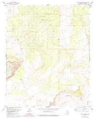
1977 Map of Long H Ranch
USGS Topo · Published 1984About this map
Long H Ranch sits at the heart of this high-plateau landscape in Apache County, representing the specialized ranching economy of the Arizona high country during the 1970s and early 1980s. The terrain is defined by a sparse network of water sources and transit routes, with multiple Water Tanks distributed across the range to support livestock. Toward the south, the topographic relief drops into the drainage of Hardscrabble Wash, where the landscape becomes more dissected. Small-scale industrial activity is evident at the Gravel Pit near the southern boundary, likely serving local road maintenance. This survey, updated with 1982 photogrammetric data, captures a transitional era of land management where traditional ranching operations relied on an extensive network of Jeep Trails and unnamed Trails to navigate the undulating plateaus of the Colorado Plateau province.
Find a feature on this map
8 named features on this map. Tap any name to fly to it.
Don’t see what you’re looking for? This feature index may not catch every label — zoom into the map to look around manually.
Map Details
Editions of this 1977 Long H Ranch Map
2 editions found

Other maps of this area

1886 · St Johns
USGS Topo · 1:250,000

1892 · St Johns
USGS Topo · 1:250,000

1954 · Saint Johns
USGS Topo · 1:250,000

1955 · Adamana 4 NE
USGS Topo · 1:24,000

1955 · Wolford Springs 3 NW
USGS Topo · 1:24,000

1955 · Hunt
USGS Topo · 1:62,500

1957 · Saint Johns
USGS Topo · 1:250,000

1958 · Saint Johns
USGS Topo · 1:250,000

1962 · Saint Johns
USGS Topo · 1:250,000
1974 · Ninemile Seep
USGS Topo · 1:24,000