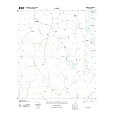
2012 Map of Prosperity
USGS Topo · Published 2012About this map
Prosperity and its surrounding rural landscapes in Holmes County are defined by the winding course of the Choctawhatchee River and a network of named settlements. The geography here is marked by distinct communities such as the Arrant Settlement and Baker Settlement, reflecting a history of family-centered clusters in the Florida Panhandle. Water is a constant presence, from the natural clarity of Vortex Spring to the scattered ponds like Hood Lake and Little Sand Pond. These water bodies and the various crossings, such as Bounds Crossing and Bayou Crossing, highlight how the natural hydrology has dictated the movement of residents and the placement of infrastructure. The land rises into several named elevations, including Pleasant Ridge and Hickory Hill, which provided high ground for landmarks like the Pleasant Ridge Cem. Along the river, features such as Bearpen Landing and Swamp Field Landing indicate the historical importance of the river as a vital artery for local commerce and transport.
Find a feature on this map
118 named features on this map. Tap any name to fly to it.
Don’t see what you’re looking for? This feature index may not catch every label — zoom into the map to look around manually.
Map Details
Editions of this 2012 Prosperity Map
This is the sole edition of this map. No revisions or reprints were ever made.
Other maps of this area

1935 · De Funiak Springs
USGS Topo · 1:48,000

1938 · De Funiak Springs
USGS Topo · 1:62,500

1948 · Ponce De Leon
USGS Topo · 1:24,000

1949 · Glendale
USGS Topo · 1:62,500

1949 · Hinsons Cross Roads
USGS Topo · 1:24,000

1949 · Hobbs Crossroads
USGS Topo · 1:24,000

1949 · Caryville
USGS Topo · 1:24,000

1950 · Hobbs Cross Roads
USGS Topo · 1:24,000

1950 · Prosperity
USGS Topo · 1:24,000

1950 · Ponce De Leon
USGS Topo · 1:24,000