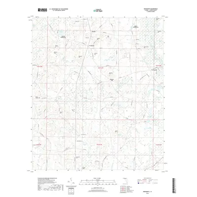
2018 Map of Prosperity
USGS Topo · Published 2018About this map
Arrant Settlement and Baker Settlement anchor this portion of Holmes County, reflecting a landscape defined by small clusters of community and family-named landmarks. The terrain is characterized by a high density of named bays and ponds, including Rattlesnake Bay, Peacock Pond, and Andrews Lake, which dot the pine-covered lowlands. Higher ground is clearly marked by a series of prominent rises such as Pleasant Ridge and Hudson Hill, providing the geography for local hubs like Prosperity and Hudson.
Find a feature on this map
148 named features on this map. Tap any name to fly to it.
Don’t see what you’re looking for? This feature index may not catch every label — zoom into the map to look around manually.
Map Details
Editions of this 2018 Prosperity Map
This is the sole edition of this map. No revisions or reprints were ever made.
Other maps of this area

1935 · De Funiak Springs
USGS Topo · 1:48,000

1938 · De Funiak Springs
USGS Topo · 1:62,500

1948 · Ponce De Leon
USGS Topo · 1:24,000

1949 · Glendale
USGS Topo · 1:62,500

1949 · Hinsons Cross Roads
USGS Topo · 1:24,000

1949 · Hobbs Crossroads
USGS Topo · 1:24,000

1949 · Caryville
USGS Topo · 1:24,000

1950 · Hobbs Cross Roads
USGS Topo · 1:24,000

1950 · Prosperity
USGS Topo · 1:24,000

1950 · Ponce De Leon
USGS Topo · 1:24,000