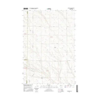
2017 Map of Prosser SE
USGS Topo · Published 2017About this map
McKinley Springs and the drainage of Glade Cr anchor this high-plateau landscape where Yakima, Benton, and Klickitat counties converge. The terrain is defined by deep incisions like Moore Canyon and Coyote Canyon, which cut through the agricultural geometry of the region. A sparse network of gravel and section-line roads, including McKinley Springs Rd and Horrigan Rd, provides the primary access to these remote draws. The map illustrates a contemporary pattern of large-scale land management typical of south-central Washington, where seasonal water sources and topographic relief dictate the placement of ranch infrastructure and transportation corridors like Glade Creek Rd and Poeckes Rd.
Find a feature on this map
21 named features on this map. Tap any name to fly to it.
Don’t see what you’re looking for? This feature index may not catch every label — zoom into the map to look around manually.
Map Details
Editions of this 2017 Prosser SE Map
This is the sole edition of this map. No revisions or reprints were ever made.
Other maps of this area

1906 · Blalock Island
USGS Topo · 1:125,000

1908 · Blalock Island
USGS Topo · 1:125,000

1915 · Prosser
USGS Topo · 1:125,000

1917 · Prosser
USGS Topo · 1:125,000

1953 · Pendleton
USGS Topo · 1:250,000

1953 · Walla Walla
USGS Topo · 1:250,000

1955 · Prosser SW
USGS Topo · 1:24,000

1956 · Pendleton
USGS Topo · 1:250,000

1958 · Walla Walla
USGS Topo · 1:250,000
1962 · Phinny Hill
USGS Topo · 1:24,000