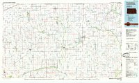
1985 Map of Protection
USGS Topo · Published 1985About this map
Cavalry Creek and Bluff Creek carve through the Southern Plains landscape of south-central Kansas and northern Oklahoma in the mid-1980s. The regional centers of Ashland and Coldwater serve as anchors for agricultural activity, connected by the sprawling network of the Atchison Topeka and Santa Fe railroad. A distinct historical marker, the Old Indian Treaty Boundary, cuts across the northern reaches of the map, providing a glimpse into the 19th-century geopolitical surveying that preceded the established county lines of Kiowa, Clark, and Comanche. Smaller, persistent settlements like Protection, Wilmore, and Buttermilk are detailed alongside local aviation infrastructure such as Stark Airport and the Municipal Airport. Terrain features like Iron Mountain and Sugarloaf rise above the drainage basins of the Medicine Lodge River and the Cimarron River, while the presence of a large Oil and Gas Field near the Oklahoma border indicates the era's energy production.
Find a feature on this map
102 named features on this map. Tap any name to fly to it.
Don’t see what you’re looking for? This feature index may not catch every label — zoom into the map to look around manually.
Map Details
Editions of this 1985 Protection Map
2 editions found
Other maps of this area

1889 · Kinsley
USGS Topo · 1:125,000

1891 · Medicine Lodge
USGS Topo · 1:125,000

1892 · Kinsley
USGS Topo · 1:125,000

1892 · Meade
USGS Topo · 1:125,000

1892 · Dodge
USGS Topo · 1:125,000

1892 · Spearville
USGS Topo · 1:125,000

1892 · Coldwater
USGS Topo · 1:125,000

1892 · Pratt
USGS Topo · 1:125,000

1893 · Medicine Lodge
USGS Topo · 1:125,000

1894 · Spearville
USGS Topo · 1:125,000