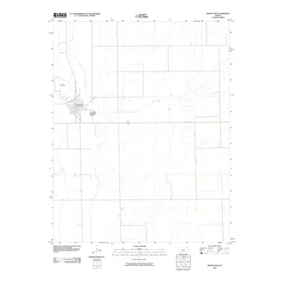
2009 Map of Protection
USGS Topo · Published 2009About this map
Protection sits at the convergence of several prairie waterways in Comanche County, where the street grid is anchored by Broadway Ave and S Jefferson Ave. The town is a focal point of commerce and transportation for this part of the High Plains, evidenced by the Protection Municipal Airport located just east of the main residential area. Several intermittent streams, including Bluff Creek and Kiowa Creek, drain the surrounding landscape, reflecting the hydrological character of the region.
Find a feature on this map
11 named features on this map. Tap any name to fly to it.
Don’t see what you’re looking for? This feature index may not catch every label — zoom into the map to look around manually.
Map Details
Editions of this 2009 Protection Map
This is the sole edition of this map. No revisions or reprints were ever made.
Other maps of this area

1892 · Coldwater
USGS Topo · 1:125,000

1894 · Sitka
USGS Topo · 1:62,500

1896 · Ashland
USGS Topo · 1:125,000

1955 · Pratt
USGS Topo · 1:250,000

1959 · Pratt
USGS Topo · 1:250,000

1979 · Sugarloaf
USGS Topo · 1:24,000

1979 · Coldwater
USGS Topo · 1:24,000

1979 · East Kiowa Creek South
USGS Topo · 1:24,000
1979 · Lexington
USGS Topo · 1:24,000

1979 · Protection NE
USGS Topo · 1:24,000