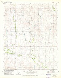
1979 Map of Lexington
USGS Topo · Published 1980About this map
Lexington serves as the central hub of this prairie landscape at the border of Clark and Comanche Counties. The settlement is anchored by the Community Hall and the nearby Lexington Cem, while smaller locales like Stephens and Burney provide further evidence of the area's rural footprint. The terrain is defined by a dense network of intermittent drainage, including Cavalry Creek, Buzzard Creek, and the larger Bluff Creek which cuts through the southern portion of the quadrangle.
Find a feature on this map
18 named features on this map. Tap any name to fly to it.
Don’t see what you’re looking for? This feature index may not catch every label — zoom into the map to look around manually.
Map Details
Editions of this 1979 Lexington Map
2 editions found
Other maps of this area

1892 · Coldwater
USGS Topo · 1:125,000

1894 · Sitka
USGS Topo · 1:62,500

1896 · Ashland
USGS Topo · 1:125,000

1955 · Pratt
USGS Topo · 1:250,000

1959 · Pratt
USGS Topo · 1:250,000

1979 · Sitka
USGS Topo · 1:24,000

1979 · Sugarloaf
USGS Topo · 1:24,000

1979 · Turkey Creek
USGS Topo · 1:24,000

1979 · East Kiowa Creek South
USGS Topo · 1:24,000
1979 · East Kiowa Creek North
USGS Topo · 1:24,000